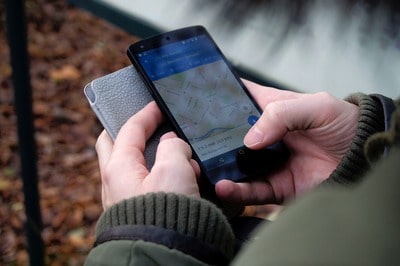
Geolocation is the act of positioning a given object, moving or not, in space and with coordinates. There are and have been many techniques to know its position, and some are still improving technologies. Positioning technologies are often linked to the economic, social and scientific development of societies. Geolocalisation is constantly being used, for example to optimise the movement of people, to follow the routes of goods, for security, health, etc. Some were even invented for military use and were later used in the public domain.
What technologies are currently in use?
The GPS (global positioning system)
GPS operates a system set up by the United States and is based on a satellite positioning system. It is a technology that was created for military purposes and was promoted in 1973 by the government. The GPS sensors of satellites orbiting the earth help to calculate the geographical position, and therefore position according to the latitude, longitude and even altitude of the device to be positioned.
As early as the 1990s, Russia also launched its own satellite geolocation system to compete with its American rival, GLONASS. It was operated by the Russian Federation's space forces from 1990 to 1996, when Russia no longer had the budget to maintain a sufficient satellite fleet. With the crisis in Russia in the late 1990s, the operational launch of this system was slowed down and only became operational again from 2010.
Finally, Europe is following suit, with the development of a European GPS project, called GALILEO, to end US-Russian dependence on positioning systems. Like GPS and GLONASS, GALILEO relies on a fleet of satellites to obtain the position of a device. The project was launched at the beginning of the 2000s, following an agreement between the European Space Agency and the European Union, and has the particularity of being only civilian. Its accuracy is supposed to be 4 metres horizontally and 8 metres in altitude and by 2018 it will reach 200 million users.
Like its political and economic competitors, China has also equipped itself with a satellite positioning system, as early as 2000, called Beidou and then Compass. It is based on the same technology and therefore has the same characteristics as the previous systems set up in the United States, Russia and Europe. All of them have a global reach.
And in practice, how does satellite geolocation work?
The entire fleet put into orbit makes it possible to grid the sky, i.e. to organize it into several spaces. Depending on the distance to the satellites, the position of each electronic device equipped with a chip can be calculated. In fact, the distance from this receiver to at least 4 satellites must be combined to obtain sufficient accuracy. The receiver can be on the ground, in motion, or in the air. However, it suffers from problems in rural areas, especially when the receiver is located in a building, in a tunnel, etc. because the received signal impacts the accuracy of the technology.
By metonymy we often use the term GPS, whereas in fact the majority of telephones currently allow the simultaneous use of all GPS, Galileo, Glonass, Compass,... systems.
The WPS (l)
The WPS is a positioning technique that uses not satellites but nearby Wifi terminals to give the position of a receiver. It was invented by a start up in Boston in 2005. The position is determined according to the intensity of the signal received, but is highly dependent on the number of access points in the vicinity. It is still an unstable technique, as it depends on the signal variations between each terminal. For this reason, WPS is mainly used in urban areas, since this is where there is a large network of Wifi terminals. It therefore offers a complementary solution to satellite geolocation in cities.
GSM geolocation
GSM geolocation uses the mobile phone network, which allows voice calls and data transfer, and passes through the antennas of the various telephone operators. Positioning accuracy is therefore subject to the density of the antenna network.
Radio Identification
Either RFID, Radio Frequency Identification, it uses markers, or radio tags to store and retrieve data remotely. These are generally adhesive labels on products, or chips used for animals for example. Radio tags consist of an antenna associated with a microchip that allows them to receive and respond to radio requests from the transceiver. They always have an identifier. This technology, used since 1935, now has applications in many areas of daily life, both in the public and private spheres. Since 2005, markers have become widely used in passports, transport or payment cards, for certain pets such as dogs and cats, etc...
It is a constraining system, because the markers can only be picked up in a field of up to 200 metres, whether they are passive, i.e. not emitting a position, or active, emitting a position.
Geocoding
This geolocation technique makes it possible to assign geographic coordinates to an address. It is based on the automatic processing of personal and professional addresses, of particular points of interest, etc... The geographical coordinates are then obtained to locate each location on a digital map. It is an interesting geolocation technique for example in the case of marketing targeting according to specific criteria. Although this technique is still imprecise, it offers the advantage of being able to group together in a simple and precise way the whole of a group of people, customers, companies etc...
Unfortunately, few techniques are completely reliable, as some are still under development and improvement, as is the case with satellite geolocation. Others depend on the density of the networks on which it is based, such as GSM or WPS. For accurate geolocation, the optimum is to combine geolocation techniques. Thus, by cross-referencing the different techniques, we can achieve greater reliability and accuracy in geolocation estimation.


